
Wavve Boating: GPS, Map, Chart
Research answer
What AppTrendKit can say about Wavve Boating: GPS, Map, Chart today
Wavve Boating: GPS, Map, Chart has no estimate-backed download or gross-consumer-spend figure that meets the public evidence contract yet.
Observed App Store metadata, chart positions, and history are shown below. Missing, non-finite, undefined-currency, or undefined-metric evidence stays missing rather than becoming zero.
Performance
Downloads, revenue and chart history
Estimates for the last 7D. Chart positions come from the App Store; downloads and revenue are AppTrendKit estimates, shown as a size band (for example 10K–50K) with a confidence level.
Estimated downloads · 7D
UnavailableNo estimate yet
We only show an estimate once we have enough data. Missing numbers are never shown as zero.
Estimated App Store gross consumer spend · 7D
UnavailableNo estimate yet
We only show an estimate once we have enough data. Missing numbers are never shown as zero.
History
Collected daily performance
No daily history yet.
Rank history
Chart positions
Lower rank is better. Only collected observations are shown.
- Free
- #94
- Paid
- —
- Grossing
- #12
- Free
- —
- Paid
- —
- Grossing
- #13
| Date | Free | Paid | Grossing |
|---|---|---|---|
| Sep 27, 2026 | #94 | — | #12 |
| Sep 28, 2026 | — | — | #13 |
Coverage note
What the ranks mean
A missing rank is not treated as zero downloads or zero revenue. Apple chart feeds are bounded and may return censored or not-ranked observations outside the visible chart depth.
Read the methodApp Store search
Keywords Wavve Boating: GPS, Map, Chart ranks for
Observed positions in Apple's US search results, best first. Popularity is a 0–100 index, not a search count.
| Keyword | Position | Change | Popularity | Difficulty |
|---|---|---|---|---|
| boat | #13 | new | 62 | 54 |
Storefront mix
Top countries by estimated contribution · 7D
Country figures cover the days we collected in each country, so they don't add up to the worldwide estimate. Each country shows when it was last updated.
Monetization
How the app makes money
These are listing and product observations. They are not company revenue, subscriber counts, or advertising revenue.
App details
Store metadata
- Version
- 5.9.6
- Released
- Aug 12, 2017
- Last updated
- Sep 25, 2026
- Content rating
- 4+
- Default storefront
- CA
Public IAP observations
Validated in-app purchase prices
Only persisted rows with an explicit public publication boundary are shown. Missing price, currency, country, or date values stay unknown.
Listing detail
What the store says
Ever have a stressful day navigating on the water? Wanted to know more about the conditions you are about to head into? Are you looking for exciting places to explore, the best place to refuel, or just trying to meet up with a friend? Wavve Boating takes a new spin on traditional boating navigation by bringing detailed nautical charts, tide predictions, weather forecasts, and more in one easy-to-use tool. Join a fast-growing community of boaters building a network of marine knowledge that everyone can enjoy. With Wavve Boating you get: - Simple and Seamless Marine GPS Navigation - Put away overcrowded and complex charts and apps. Wavve Boating's GPS focuses on important and relevant information so that navigating is as easy as staying in the blue and avoiding the red. - Custom Nautical Charts - View and change Wavve Boating's nautical charts based on your unique boating needs and preferences. Set your draft and Wavve Boating redraws the nautical charts to fit your boat. Nautical charts are available for the USA, Canada, Australia and the UK. You can view a map of our coverage on our website. - Community Boating - Just like at the dock or on the water, we all help each other in Wavve Boating. Share expert knowledge of the local waterways by adding shared points of interest to the map. The community can vote on pins, making sure they are all valid and valuable. Not quite ready to share a great find? No problem, you can keep your points of interest private as well. - Tides - Track changes in water height in tidal regions and along rivers and lakes with the tides function. View a body of water in North America, and the app will update to reflect the current water levels. View predicted water heights up to 18 hours in advance and track the next tidal variances. - Weather - Check the weather, including a complete seven-day forecast, across all of North America. Easily view the temperature, wind speed, and wave height as you move around the map. The local daily forecasts are color-coded to show if it is dangerous to go boating, using guidelines from the Coast Guard's small vessel advisory. - Fleets of Friends - See who is on the water and where they are by adding friends to your fleet. Share your locations with members of your fleet to make meeting up a breeze. Want to keep your best fishing hole a secret, even from your boating buds? Easily hide your location to boat under the radar. So Long Chart Plotters Marine navigation is more than concentrating on a cluttered chart plotter. Get your head out of the cabin and enjoy the journey. Stop buying marine charts piece by piece for your chart plotter. Wavve Boating has integrated all the marine charts into one map for your boating GPS needs. Subscription Pricing and Terms Wavve Boating is free to download, and all customers are welcome to a free 14 day trial period. Should you choose to continue to use the Wavve Boating app after the free trial, we offer two auto-renewing subscription options, monthly ($11.99/month) or yearly ($69.99/year). Wavve Boating needs you! We've built the platform, but it is boaters that will build our Wavver community. Share your knowledge, share your time, and save a prop or two in the process. Current chart data includes coastal the United States and Canada, The Great Lakes, The St. Lawrence River and portions of the Caribbean. You can view a map of our coverage at https://wavveboating.com/map MORE INFORMATION Want to learn more about Wavve Boating’s marine navigation aid? Still deciding if this is the right boat GPS app for you to replace your chart plotter? Looking for an alternative to Navionics, Embark, Garmin Active Captain or other? Head to our website to learn more. TERMS OF SERVICE https://wavveboating.com/terms-of-service/ PRIVACY POLICY https://wavveboating.com/privacy-policy/
Publisher websiteStore creative
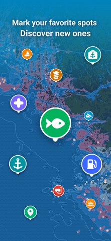
Screenshots



Competitive set
Similar apps
Deterministic links to real stored apps matched by category, publisher, and comparable performance bands.

onX Hunt: GPS Hunting Maps
onXmaps, Inc.

Coyote : radar, GPS & CarPlay
Coyote System

Trucker Path: Truck GPS & Fuel
Trucker Path Inc.

Geovelo - GPS & Stats vélo
La Compagnie des Mobilites

Mappy - GPS, trafic & prix
MAPPY SA

Speedometer 55 Start. GPS Box.
Stanislav Dvoychenko

Topo GPS - Topografische kaart
rdzl

Google Maps
Google LLC
How we estimate
Where every number comes from
App details: Apple iTunes Search API, updated Sep 27, 2026, 10:54 PM.
Rankings: collected chart positions from the listed storefront. Missing ranks are not zeros.
Economics: downloads and gross store consumer spend are estimated, not official Apple or publisher figures.
Model: Lineage not exposed by this aggregate.
Confidence: —; intervals widen when evidence or history is limited.
Last updated: Sep 29, 2026, 10:01 AM.
See how AppTrendKit separates observations, estimates, coverage, and confidence.
Open methodology